Home
Home
 Me
Me
 Living
 Sport
Sport
 Work
Work
 Contact
 Germar's Monthly Updater
|
January 2002: Travels to South Pole and McMurdo
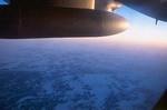
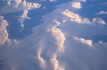
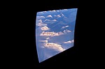
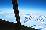
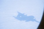
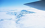
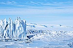
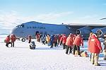
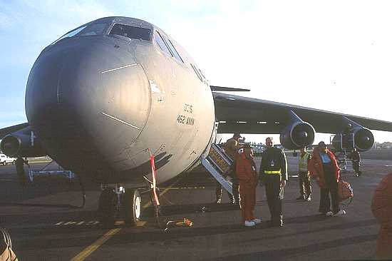
I left San Diego on January 6, and flew on commercial aircrafts to Christchurch, located in the middle of New Zealand's South Island. After receiving "Extreme Cold Weather" gear, I boarded together with some 30 colleagues a Hercules C-130 military aircraft, which brought us to McMurdo Station. The pictures below were taken during the nine-hour flight (Click on thumbnails for enlargement!).
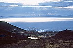
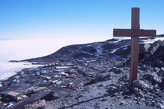
I arrived in the early morning at McMurdo station. As the flight to the South Pole was scheduled for the next day, I had time to climb the 228 m high Observation Hill, which provides the best views of McMurdo. The cross on top commemorates Captain Scott and his party who lost their lives on their epic journey to the South Pole in 1912.
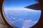
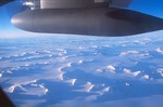
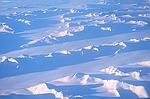
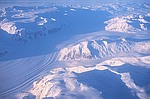
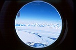
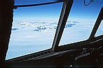
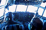
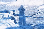
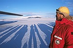
There were only few people on the flight to the South Pole, and I therefore had the opportunity to be in the cockpit for some time. I was surprised to learn that there is a sextant on board, which can be used for navigation if all electronic equipment should fail. In fact, navigation by GPS and gyro compass has larger uncertainties when approaching the poles than it has elsewhere, and observations with sextant are therefore still routinely performed. There is a special hole near the top of the aircraft's hull where the sextant can be inserted, and the navigator was so kind to show me the procedure. The pictures below were all taken enroute to the Pole.
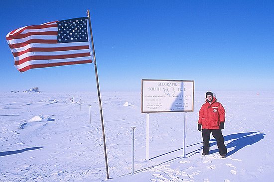
Here I am, next to the Geographic South Pole. The board next to me commemorates the expeditions of Roald Amundsen and Robert F. Scott in 1911/12. The Pole is marked by the short metal rod between the board and the flag.
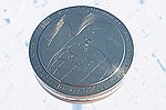
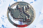
The position of the Pole is determined every year by the U.S. Geological Survey. The Pole moves about 10 meter each year relative to the station as the 3000-meter-thick ice sheet moves by this amount over the Antarctic continent. A new marker for the Pole is designed every year. The markers for 2000 - 2002 were still mounted on their rods and are shown below.
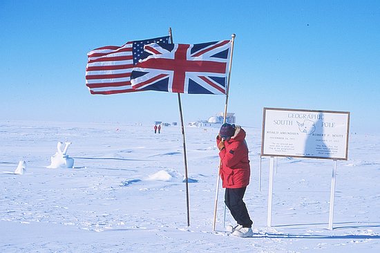
January 17, 2002, marked the 90-year anniversary of Scott's arrival at the South Pole. A short ceremony was organized during which a member of the British Antarctic Survey planted the British Union Jack next to the U.S. flag, which is flown permanently at the Pole.
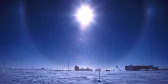
Atmospheric phenomena that can often be seen at the South Pole are halos around the sun and "sun dogs". They are caused by refraction of light by hexagonal ice crystals flying through the air. In the picture below, the halo is framing the dome of the "old" South Pole station. The building to the right is the new South Pole station, that is currently under construction. Sun dogs at the South Pole are most impressive. One awesome example is here.
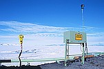
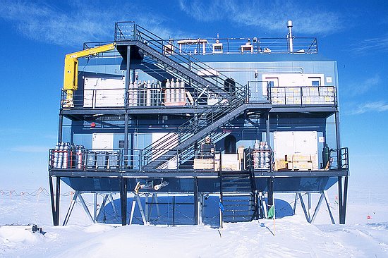
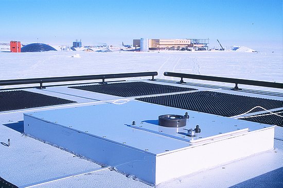
My work place at the South Pole is the Atmospheric Research Observatory, located upwind of the main station to avoid contamination of air sampling. The building was erected in the 1997 and provides superb infrastructure. The UV spectroradiometer that I was servicing is located in a penthouse behind the yellow crane.
Below is the top of the penthouse containing the spectroradiometer. The black cylinder with the white insert belongs to the instrument's entrance optics. In the background are the orange "Skylab", the dome of the old South Pole station, and the new station.
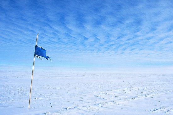
On the last day of my stay at the Pole, I walked to the "Spreso" field site. Spreso stands for "South Pole Remote Earth Seismic Observatory". Currently several hundred meter deep holes are drilled into the ice, which will then be equipped with seismometers. The flag below marks the road to Spreso.
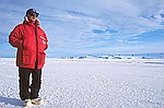
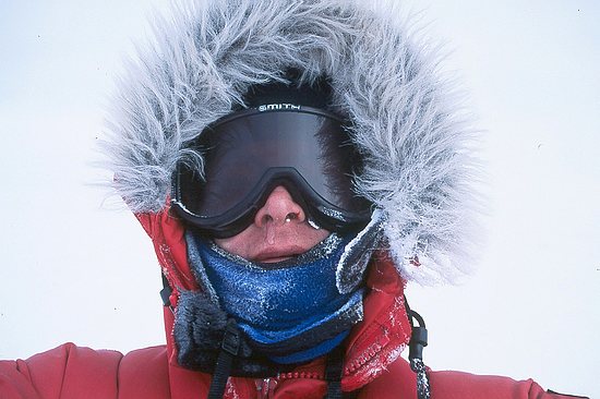
Here I am on the way back, showing typical signs of cold weather (the wind chill was about -50ºC): Frozen snot under my nose, chapped lips due to low moisture, and a bit of frost bite on my right cheek - but happy.
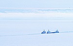
The next day, I flew back to McMurdo. Below are a couple of pictures from this leg.
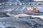
Back in McMurdo, I spent most of the time calibrating, servicing, and upgrading the UV spectroradiometer located there. At least I managed to have one day off. I went to Hut Point, located at the end of McMurdo's harbor, and to New Zealand's station "Scott Base". Some impressions are below.
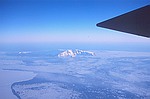
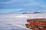
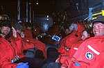
Finally, the day of departure from the ice arrived and me and 90 colleagues were transported to the "Pegasus" ice runway, located on the Ross Ice Shelf about 14 km away of McMurdo. From here, the view was awesome with Mount Erebus (the only active volcano in Antarctica) to the North-East, Mount Discovery to the South-West and White Island to the South-East. We had to wait at the air field for about three hours, and it was worth every minute. Constantly changing light and cloud conditions provided a perfect scenery for saying Good Bye to Antarctica.
After five hours of torture, we finally arrived in Christchurch. It is always a surprise to make the first breath outside the aircraft. After several weeks on the ice, the nose appears to gain sensitivity, and the scents of lawn, trees and flowers can be sensed much more intensely during the first minutes back in civilization.
| ||||||||||||||||||||||||||||||||||||||||||||||||||||||||||||
|
Top | Updates from 2002 | Current Updater
Last updated: 23 January 2016
|
||||||||||||||||||||||||||||||||||||||||||||||||||||||||||||