Home
Home
 Me
Me
 Living
 Sport
Sport
 Work
Work
 Contact
 Germar's Monthly Updater
|
Utah 2002
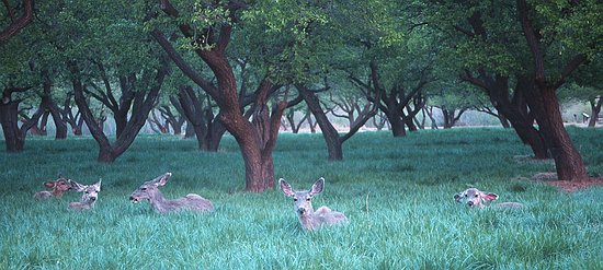
Day 6 As pointed out earlier (see Day 4), we sometimes had to share our tents with some critters. This night, we didn't see scorpions or mice, but deer. They are a lot harder to squash. At least I cannot remember that a fellow camper reported to have slept on a deer. In contrast, I felt a bit like a mouse when I saw their large shadows moving over our tent's roof, and prayed that they don't step on me.
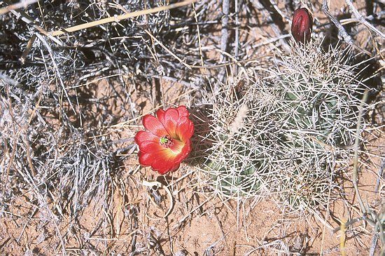
The schedule for the morning was to hike to another arch, the Hickman Bridge. The sight was conveniently located 2 miles from the campground, and the trail went through some piles of rock ...
... passed some nicely flowering cacti ...
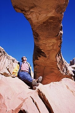
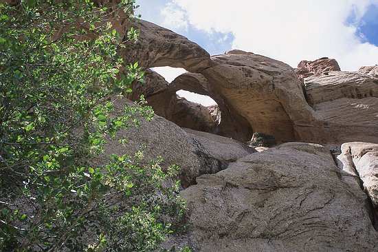
... and finally ended at the arch.
Dennis and me decided to climbed on top of the arch. It was a bit tricky and we had to support each other at one place. But finally we made it!
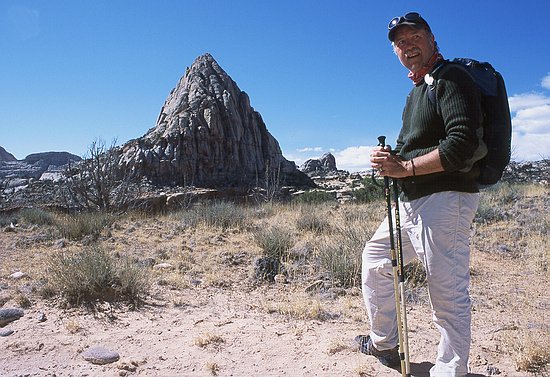
Well, I couldn't find a name for this mountain. We passed it the other day on the way to Cassidy Arch.
After the leisurely morning stroll we went back to our Jeeps and headed South on the Notom-Bullfrog Road, which follows the Waterpocket Fold. We eventually turned West, drove up the Burr Trail Switchbacks, and took a sidetrip to another arch and viewpoint. The road was quite good, and with the "sway bar" removed the axles of our Jeep were nicely articulating:
The arch turned out to be double arch. That's really nicely arranged by the National Park service: if one collapses, there is still the other one.
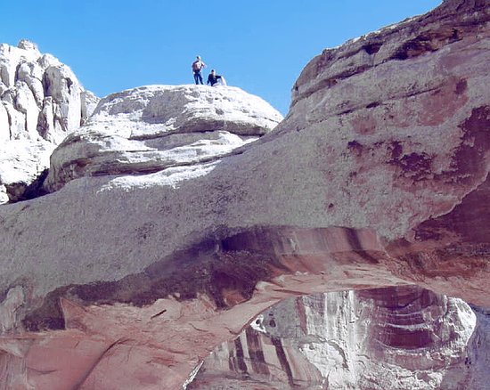
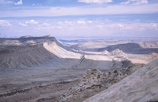
The viewpoint was really breathtaking. I climbed up a little mountain for a better view. The Waterpocket Fold was just below me. The dimensions of the fold are huge. One could comfortably build a 100-lane freeway through (and if Los Angeles continues to grow at the current rate, there is probably a need for it in 1000 years).
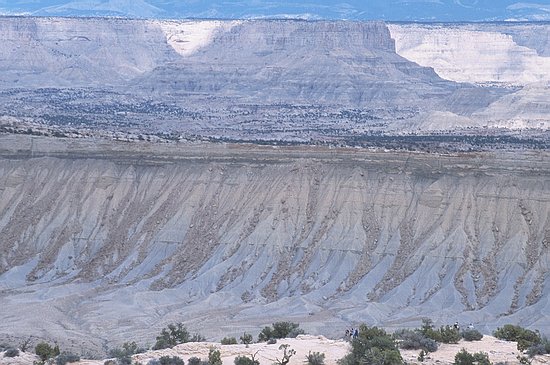
I hope that the next shot can illustrate the dimensions a bit. Note my friends standing in the foreground. The rim of the fold is about 2 miles away, and the mountain ridge in the background probably 5 more.
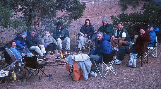
We camped close by at an elevation of 6800 feet. The temperatures dropped quite a bit during the evening (in fact, it was freezing during the night) and we therefore made a fire. Below is the circle of the brave. All but three people of our group are assembled. Two were off hiking and I was hanging in a rotten tree, looking for a decent vantage point, praying that the tree's branches don't break.
| |||||||||||||||||||
|
< Previous Day | Tour Map | Next Day > Return to: Updates from 2002 | Current Updater
Last updated: 23 January 2016
|
|||||||||||||||||||